Skytec Blog

Chattanooga Area Chamber of Commerce Recognizes Skytec with 2020 Sustainability Award
We are proud to announce that we received the Sustainability Award from the Chattanooga Area Chamber of Commerce! Find out more about how we're working to encourage sound environmental preservation practices as a business and through our client services.
Read More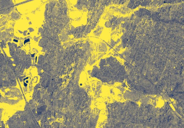
Monitoring and Mapping Floodplains with Satellite Imagery and LiDAR
Measuring floodplains and monitoring the impact of water plays a crucial role in asset management, especially as major agencies and utilities anticipate and plan for emergency response after storms. Find out how our technologies and data analytics can offer a reliable solution.
Read More
Team Profile: Andrew Mindermann
Our team enables us to do everything that we do — and each individual offers unique expertise and perspective. That’s why we’re featuring our team members on our blog and offering an opportunity for you to learn how they're contributing to our successes, as well as the overarching UAS industry. This month, we're featuring Senior Data Analyst Andrew Mindermann.
Read More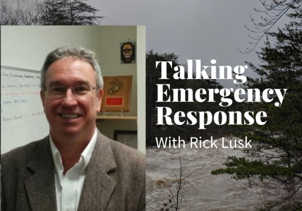
Employing Mapping and Satellite Imagery for Emergency Response
Major environmental disasters and the resulting recovery process demand an immediate, accurate response. Today, we're talking with Rick Lusk, owner of Oculus Deus, LLC and former director of the UAS Research Center at Oak Ridge National Laboratory, about how organizations can use satellite imagery and UAS to prepare for and respond to emergencies.
Read More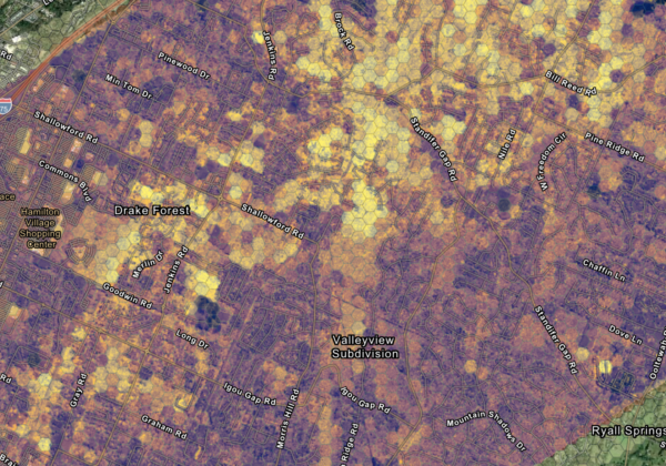
Using Satellite Imagery to Guide Natural Disaster Recovery: A Multi-agency Effort to Map Tornado Damage After Chattanooga Tornadoes
Through a community support partnership with the City of Chattanooga, Hamilton County, the University of Tennessee at Chattanooga’s IGTLab, and the Lyndhurst Foundation, Skytec created a mapping application and tornado impact index to guide agencies clearing roads, providing relief, and restoring power after April's devastating Easter Sunday tornados.
Read More
Skytec Recognized for Service and Experience in Esri Online Specialty Provider Network
After becoming an Esri Silver Partner at the beginning of 2020, Skytec has also joined the Esri's ArcGIS Online Specialty network, a cloud-based mapping and analysis platform.
Read More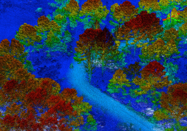
Lowest-Cost Projects Don't Yield Best-Case Data
Comparing data acquisition and analysis projects in the UAS world isn't always apples to apples. Business Development Manager Leum Monroe explains how perceived cost savings on the front end of a project may lead to headaches and costly corrective actions down the road.
Read More
Team Profile: Douglas Madrid
Our team enables us to do everything that we do — and each individual offers unique expertise and perspective. That’s why we’re featuring our team members on our blog and offering an opportunity for you to learn how they're contributing to our successes, as well as the overarching UAS industry. This month, we're featuring Lead Pilot Douglas Madrid.
Read More
Celebrating Our 5th Anniversary With 5 Lessons We've Learned
By Bill Rogers, Co-Founder and CEO, and Andy Carroll, Co-Founder and CTOAs we celebrate Skytec's 5th anniversary, we wanted to take a moment to reflect on what we've learned over the course of the past five years, as well as share our thoughts about what's to come in the world of unmanned systems.
Read More