Skytec Blog
Part I: A Look Ahead at Our Changing Environment and Global Need for Robust Data Solutions
The world is preparing for a changing climate and robust data science solutions will be required for innovation and accountability. Skytec leaders CEO Bill Rogers and CTO Andy Carroll weigh in on trends in corporate sustainability initiatives and the need for dynamic data solutions in this two-part blog series.
Read More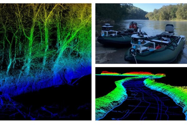
Skytec Partners with Trutta Environmental Solutions to Create Comprehensive Hydrographic Survey Tools
Combination of bathymetry and LiDAR provides in-depth data and view of stream quality for aquatic resource managers in Tennessee.
Read MoreSkytec Upholds ARGUS Platinum Safety Rating
Skytec demonstrates its commitment to safety after the company’s second ARGUS Unmanned Audit results in maintaining the highest rating an UAS organization can achieve.
Read More
Team Profile: Eric Gibson, Director of Safety
The Skytec team enables us to do everything that we do — including maintaining the highest commitment to safety in a rapidly changing industry.
Read More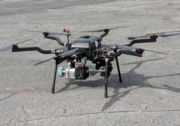
Skytec and Harris Aerial Partner on Innovative Drone Technology for Longer, More Efficient Flights
In geospatial mapping, innovative technology drives greater solutions for clients. Since Skytec’s founding, UAS technology has grown in leaps and bounds as the company adapts to ever-changing regulatory challenges and increased capabilities with sensors.
Read More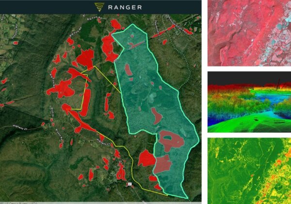
Skytec Innovates to Meet the Monitoring Needs of Land Trusts
With growing technological capabilities, Skytec recently partnered with a land trust and conservancy to provide ongoing, monthly land use monitoring services.
Read More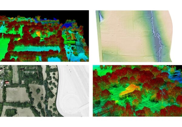
Conservation Comes to Life at Glen Leven Farm
Skytec is equipped to support the ongoing data and mapping needs of land trusts. Company leaders recently partnered with The Land Trust for Tennessee to provide ongoing monitoring and mapping services to support The Land Trust’s historic Glen Leven Farm in Nashville, Tennessee.
Read More
Skytec Launches Dynamic Study to Monitor Water Quality in the Sequatchie Valley
Skytec is constantly uncovering dynamic and valuable applications for its acquisition tools, including high-resolution satellite imagery, that have the potential to positively impact the environment.
Read More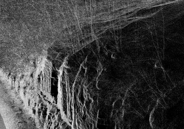
Enhanced Capabilities and Mapping with LiDAR
LiDAR, or light detection and ranging, for remote sensing and 3D mapping is a Skytec specialty. With a range of tools and a team of experienced technologists and data analysts, we deliver a premium LiDAR data product acquired through mobile, UAS, or manned aircraft.
Read More