Blog
Biodiversity Monitoring and Management with Remote Change Detection
- Biodiversity, or the variety of species of flora and fauna, is in decline and faces threats from invasive species, climate change, and pollution.
- Ranger, a tool from Skytec, enables clients to incorporate authoritative biodiversity datasets that identify at-risk ecosystems and species.
- These datasets help clients meet sustainability commitments with actionable data for responsible sourcing and supply chain management.
Conservation and management of biodiversity demands appropriate tools, data, and maps. Using Ranger™, Skytec guides clients across industries to monitor and manage biodiversity conservation efforts.
According to leading conservation research group NatureServe, 40% of animals and 34% of plants in the United States are at risk of extinction. How can we protect biodiversity and slow the loss of millions of species of flora and fauna? That’s the question many organizations are asking.
Increasingly, satellite imagery and remote change detection plays a significant role in data-driven decision-making as organizations manage and monitor biodiversity efforts.
What is biodiversity?
Biodiversity is the variety of life, including plants and animals, inhabiting this planet. Geospatial analysts in the nonprofit and private sectors, as well as commercial partners such as Esri,are committed to understanding the essential questions for protecting biodiversity and building out key datasets that identify at-risk ecosystems and species.
How can an organization work toward protecting some of the planet’s most sensitive ecosystems and species while simultaneously tracking threats such as invasive species, climate change, and pollution? The answer lies in the Skytec’s Ranger solution, which employs datasets, including Esri’s biodiversity data, to deliver crucial information on at-risk species and ecosystems for efficient and informed decision making.
Biodiversity and the Supply Chain
Conservation organizations aren't the only global players considering and preserving biodiversity. Globally, commercial organizations across industries are committing to sustainability goals that require definitive milestones with actionable analytics to stakeholders and customers.
Skytec’s Ranger helps organizations stay accountable to their conservation and sustainability goals. Whether for forestry, environmental management, architecture, engineering and construction, or electric utilities, Skytec delivers actionable data about biodiversity and sensitive ecosystems across the globe through the intuitive and familiar Esri platform. Skytec’s Ranger application enables leaders to Monitor What Matters anywhere on the planet.
Ranger empowers clients by providing access to high-resolution satellite imagery and remote change detection. Clients can monitor properties almost anywhere on Earth, with change detection available as frequently as every week. Ranger leverages its integration with the Esri platform through the incorporation of various authoritative biodiversity data, including NatureServe’s Species Habitat Modelings and Map of Biodiversity Importance, to inform decision-making.
“We incorporate biodiversity data sets into Ranger, which enables us to help clients do a better job with responsible supply chain management and sourcing,” says Andy Carroll, CTO and Cofounder of Skytec. “The integration of these datasets are a differentiator and it enables us to expand what we can do with Ranger, especially as it pertains to supply chain management.”
Protecting Diverse Life Forms
With biodiversity in decline and increasing rates of species extinction, industry leaders are demonstrating and validating steps toward documenting conservation and sustainability goals with Ranger. This is illustrated by one of Skytec’s forestry clients who uses a custom GIS tool to establish best practices for harvesting, enabling the company to protect sensitive species and ecosystems.
“Stakeholders want answers,” says Bill Rogers, CEO and Cofounder of Skytec. “The integration of the authoritative biodiversity data from Esri into Ranger allows our clients to proactively protect biodiversity and continually monitor land use change in sensitive areas. As more imperiled habitats and their associated species face extinction, our clients are demonstrating how Ranger reaffirms commitment to the environment and provides them with the necessary tools to manage biodiversity with actionable data and best practices.”
Learn more about Ranger and contact us to get started.
Skytec Blog

Utilities Can Reduce Risk and Optimize Vegetation Management with Skytec’s Remote Monitoring
Skytec combines satellite imagery and remote change detection to build 3D models or digital twins and better visualize areas of risk in vegetation management for utilities.
Read More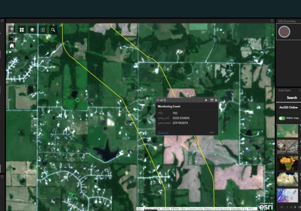
The Evolution of Change Detection Technology: Ranger Delivers Actionable Analytics Across Industries to Reduce Costs and Gain Efficiencies
With Skytec’s Ranger platform, you can Monitor What Matters with change detection technology to deliver ROI, solve problems, minimize downtime, and advance business.
Read More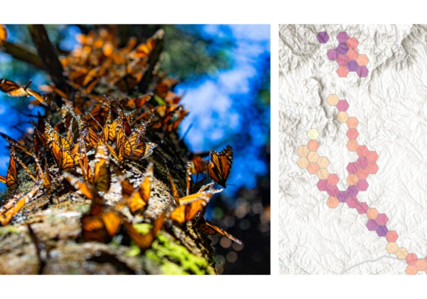
Biodiversity Monitoring and Management with Remote Change Detection
Conservation and management of biodiversity demands appropriate tools, data, and maps. Using Ranger™, Skytec guides clients across industries to monitor and manage biodiversity conservation efforts.