Drone Solutions
High Resolution Mapping and Verification
Whether you call it unmanned, UAS, UAV or drone — we’ve been mapping with this technology since 2015. We have partnered with multiple manufacturers to provide the optimal combination of aircraft and sensors to efficiently deliver high quality data safely on every flight.
The drone platform, combined with LiDAR and specialized mapping cameras, provides centimeter-level data, providing the highest level of detail and documentation. When assets or resources change and design-grade verification is needed, drone mapping is the go-to solution.
Providing design-grade mapping products and digital twins requires a combination of the right equipment and experience. Skytec's drone mapping solutions deliver high accuracy, reliable, and repeatable results.
Skytec delivers drone mapping products through industry-leading GIS applications and enterprise integrations powered by Esri technology.
Skytec’s flight department is comprised of a team of expert pilots. Through rigorous training and operational standards, our team maintains the knowledge, experience, and technology required to safely collect premium data.
How We Work
Innovation in Drone Imagery Innovation, change, and technological evolutions are woven in the fabric of our business. Since 2015, we’ve adapted to the change and challenges of drone and geospatial imagery. Our experience positions us as a leader in safely operating, collective data, and delivering accurate information efficiently.
Client Collaboration We tailor our services to your business needs through collaborative partnerships. We embrace your expertise and work shoulder to shoulder through acquisition, analysis, and information delivery for the optimal solutions and services.
Macro to Micro Skytec’s Ranger and drone mapping solutions enable you to monitor assets at scale from satellite imagery and, when changes are detected, capture the highest resolution data from the drone platform.
Partnering with Industry Professionals Get reliable, repeatable results from drone imagery. We always integrate control from licensed professional surveyors. Reach challenging landscapes and topography with expert data capture. Our team of expert analysts and pilots bring depth of experience flying advanced equipment for the optimal results. We deliver timely, accurate data solutions backed by our GIS and mapping knowledge and experience.
DRONE SOLUTIONS
Whether collecting for terrain modeling or imaging, our experience in flight operations, GIS expertise, and premium drone systems combine to deliver industry-leading products.
LIDAR
Examine terrain, infrastructure, and other hard-to-see ground surfaces with Light Detection and Ranging (LiDAR).
Our LiDAR mapping capabilities combine the highest quality laser scanning and drone hardware available. Our hardware is only matched by our capability to process and derive client-specific data.
Learn MorePhotogrammetry
Understand your site or service area and its unique characteristics with our specialized mapping camera systems.
Accurate and cloud-free, high-resolution images drive informed decisions about conditions of your project site or service area. We deliver a wealth of imagery and derivative products through photogrammetric analysis in industry leading GIS software.
Equipment
Our cutting-edge sensors and aircraft distinguish Skytec as a leader in drone mapping and support our satellite-to-centimeter imaging and change detection solution on the Ranger platform.
Aircraft
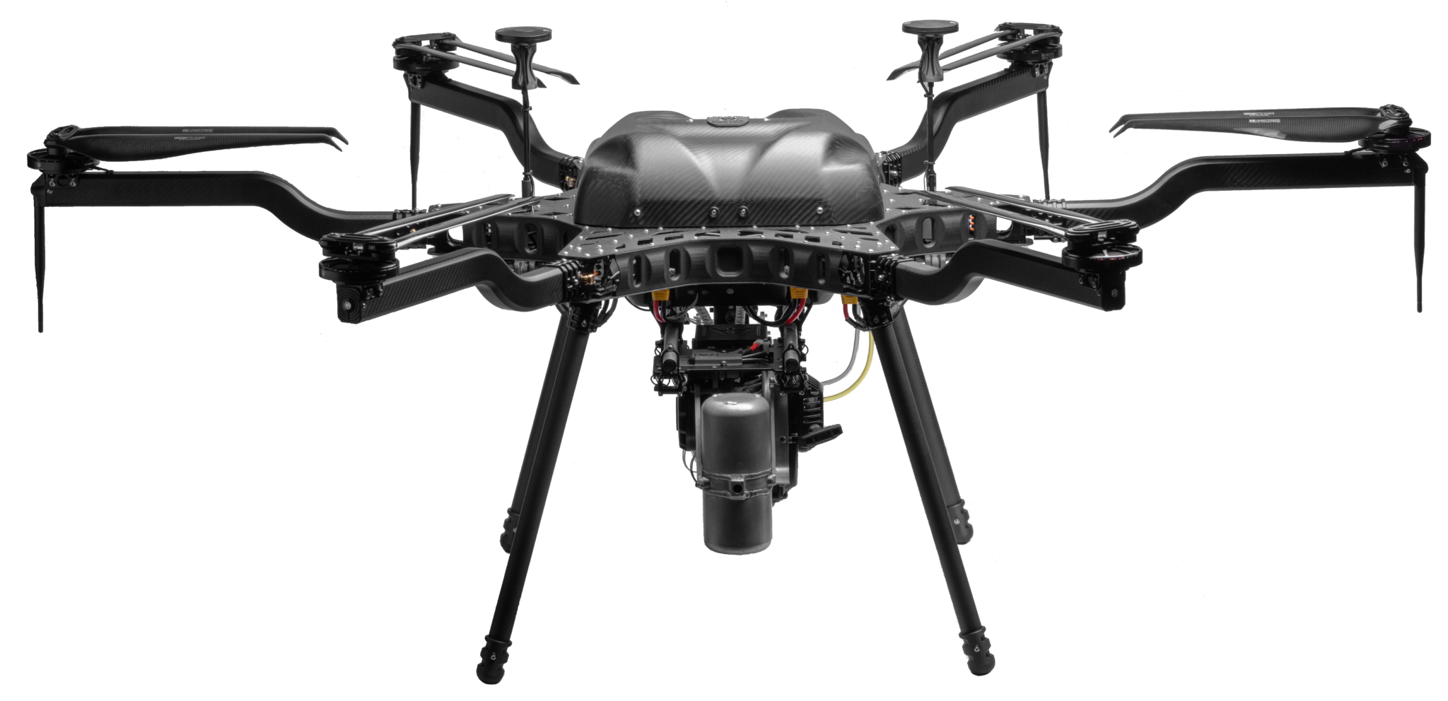
Harris H6
Powered by advanced technology, the Harris H6 is a hybrid drone designed for efficiency and adaptability. With flight times surpassing 1.5 hours when equipped with LiDAR payloads, it excels at large-scale data collection, capable of capturing up to 500 acres in a single flight. This heavy-lift drone supports a variety of sensor payloads and configurations, offering a versatile and effective solution for your geospatial data collection needs.
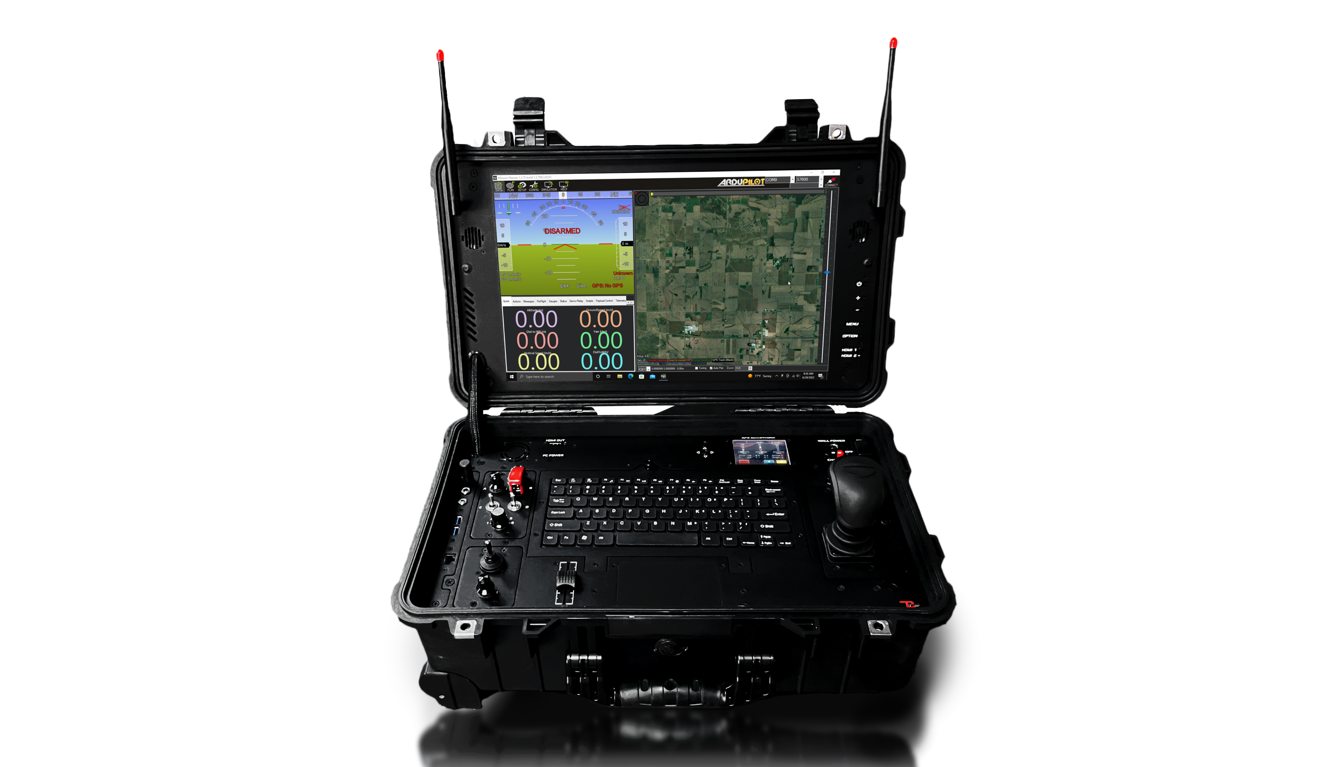
Ground Control Stations
Our aircraft and sensors are supported by state-of-the-art, professional ground control stations for piloting and managing drones during acquisition.
Sensors
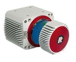
Riegl VUX-1UAS
A lightweight, premium, compact laser scanner that meets the challenges of emerging drone mapping solutions both in measurement performance as well as in system integration.
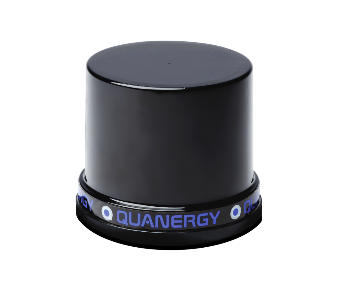
Quanergy M8
This compact and rugged sensor meets the demands of the most challenging real-world applications. Multiple laser beams and Time-of-Flight (TOF) range measurement result in 3D point clouds for spatial modeling.
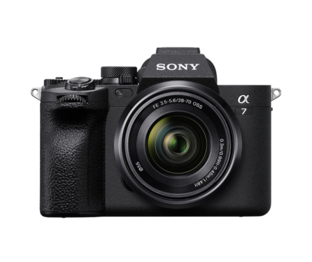
Sony Alpha 7
This mirrorless camera with 64 megapixels delivers high-resolution, full-frame image sensors known for exceptional detail and sharpness and ideal for GIS applications.
SAFETY
Safety and risk management distinguish Skytec as a true aviation program.
Safety is the top priority in everything we do, embedded in our aviation practices and as the foundation for client relationships. Our Safety Management System approach identifies and mitigates risk and positions us as a leader in the industry. We accommodate specific insurance requirements, vetting processes, and extensive qualifications for clients.
Aviation Resource Center (ARC)
Skytec has developed our Aviation Resource Center to help manage, electronically, our Safety Management System (SMS). Whether online or through our app, Skytec personnel can document, track, audit, and communicate pertinent information regarding risk management. This SMS approach drives positive change to policy and procedures in all of our operations.
Experienced Team
Skytec Remote Pilots are some of the best in the industry. All Skytec full-time Remote Pilots are rated both in unmanned aircraft as well as manned aircraft. This approach enhances our ability to work closely with the Federal Aviation Authority (FAA), Air Traffic Control (ATC), and be familiar with Crew Resource Management (CRM) and good Decision Making (DM) concepts. To achieve the high level of professionalism required by Skytec senior leadership, we have developed our own Internal Training Program to ensure Skytec's core values, industry best practices, and experience-based procedures are engrained into each remote pilot we hire.
Additional, industry-specific safety training for our flight crews includes:
-
Osha
-
Msha
-

First Aid
-
CPR
This commitment to safety and the development of our industry enables Skytec to put the most experienced team in the industry to work for our clients. Through our commitment to safety in everything we do, Skytec will continue to push the unmanned industry forward.